

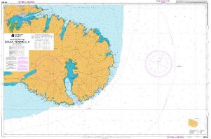
Chart NZ632 Banks Peninsula
$25.00Folded chart in a plastic sleeve.
Chart No: NZ 632
Title: Banks Peninsula
Scale: 1:75,000
Extent of Paper Chart:
43° 59.90' S – 43° 34.37' S
172° 38.00' E – 173° 32.82' E
The images provided may not be current and do not replace the New Zealand official nautical charts corrected for NTMs. These images are not designed to meet the requirements of maritime navigation at sea.